Chōkai Blue Line
menuMenu
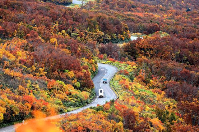
A magnificent 34.9km drive winding through Mount Chōkai. The Sea of Japan stretches out below, offering panoramic, breathtaking views.


Highlights
- Breathtaking views of the Sea of Japan and Mount Chōkai
- Varied scenery, including beech forests and grasslands
- A comfortable road perfect for a scenic drive
- Beautiful nature throughout the four seasons
- Rest stop at Ōhira Sansō at the summit
Basic Information
- Address
- Fuipura, Yuzawa-machi, Akumi-gun, Yamagata Prefecture Search for tourist attractions in Yamagata
- Access
- From Yamagata Prefecture: Via National Route 7 (Chōkai Blue Line entrance intersection) or National Route 345 (Jūroku Rakan intersection), and Yamagata Prefectural Route 210 Chōkai Park Fuipura Line (Chōkai Blue Line). From Akita Prefecture: Via National Route 7, Akita Prefectural Route 58 Shōgata Yashima Line, and Akita Prefectural Route 131 Chōkai Park Kotaki Line (Chōkai Blue Line). Show route
- Op.Hours
- Late April (Chokai Blue Line opening) to late October
- Cld.Days
- Typically closed during winter from early November to late April.
- INFO
- Road closures and restrictions may be in place after opening, before closing, and during inclement weather. For the latest information on restrictions, please check the Yamagata Prefecture road closure information, Akita Prefecture road closure information, and road traffic information websites.
Overview

Recommended nearby attractions
Nearby Hotels
Travel Essentials
Tourist Spots by Theme
Tourist Spots by Region